MetroQuest
A case study in Visualization, Engagement, and Urban Planning.
I created a website using the MetroQuest platform as part of the Vancouver Greener City Project that allowed citizens to visualize the changes to their neighborhood in 3D under different Land Use, Transportation, and Energy scenarios.


ElementsLAB
The elementsLAB, directed by Professors Ron Kellett and Cynthia Girling, seeks to compile a database of 3D case studies to help inform researchers, community members, policy makers, elected officials, and city planners whose goal is to improve environmental health by integrating compact, mixed use urban development with healthy, “working” landscape.
My primary responsibility was to go out into Vancouver city, gather images and data from modern Vancouver housing stock, then come back to the lab and rebuild the structures in 3D. Finally, we would embed the data into models.
In aggregate, these models were used to build neighborhoods and give us a visual and numerical understanding of the result.


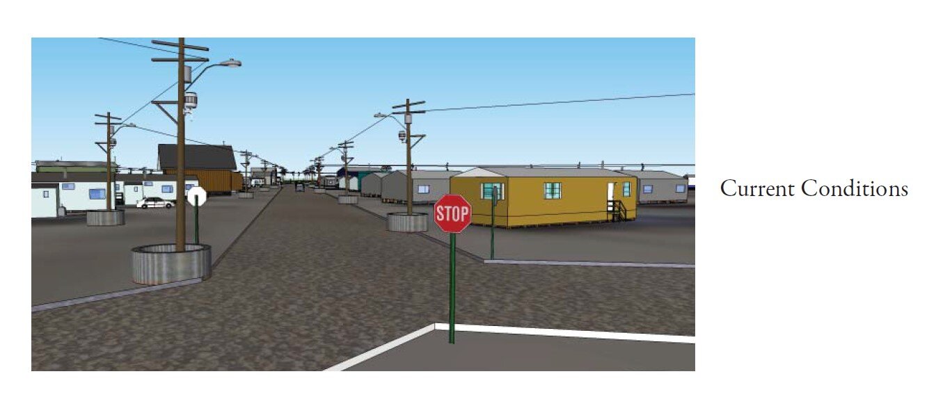
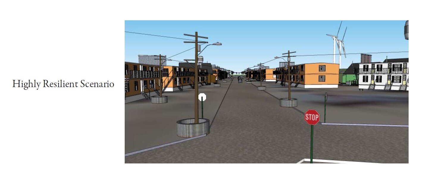
Collaborative for Advanced Landscape Planning (CALP)
Under the direction of Dr. Stephen Sheppard, the Collaborative for Advanced Landscape Planning (CALP) specializes in sustainable landscape planning and design, with a focus on visualizing local climate change impacts and solutions. CALP has been leading the development of tools and processes for visioning future climate impacts, adaptation, and mitigation strategies at the local level using 2D Geographic Information Systems (GIS), 3D visualizations techniques, and “4D visioning” of alternative futures.
Using a framework of sustainable resiliency, I examined housing, energy, and climate change indicators in a small First Nations town in Nunavut. The goal was to create an array of viable sustainable growth strategies for local community planners and citizens to consider.


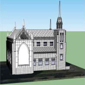
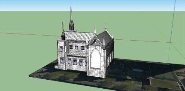
ARCH 504 - Holy Rosary Cathedral
Taken from a term project in ARCH 504 - the Holy Rosary Cathedral, downtown Vancouver.


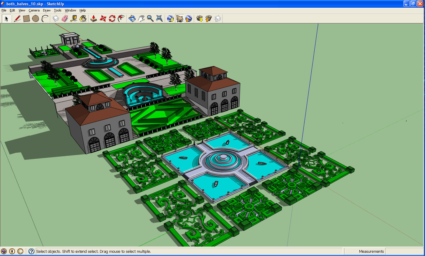
ARCH 501 - Villa Lante
Taken from a term project in ARCH 501, a 3D model of the sixteeth-century Villa Lante. This model shows a Renaissance style relic of aristocratic grandeur.

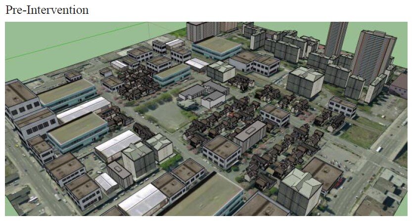
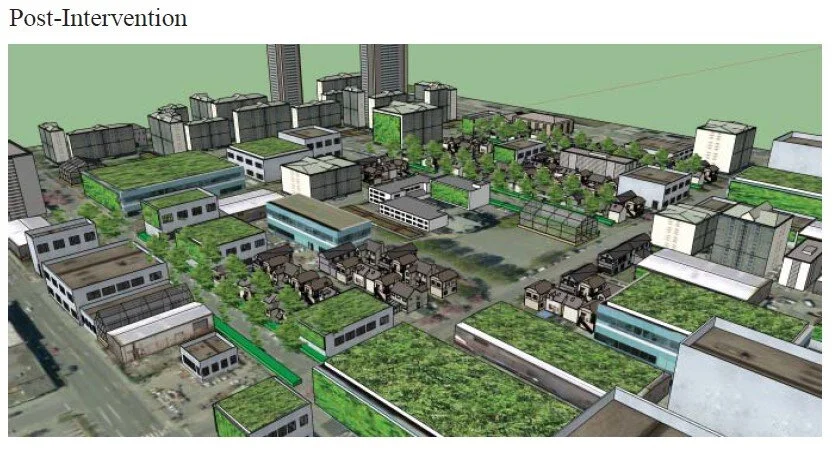
LARC 521 - Greening a Vancouver Neighborhood
As part of my academic coursework, I helped to create a sustainable local food and energy production model for an existing Vancouver neighborhood. Our methodology included a site analysis to document existing conditions, which then informed an array of potential development options. I created 3D models to show pre- and post-intervention conditions.